Connecting Our Green and Blue Spaces
Across the city centre, new and improved connections will make it more enjoyable to walk and cycle. More seamless connections to parks and waterbodies in the city will also expand the options for recreation and play.
Last updated 29 July 2025
Connecting our Green and Blue spaces
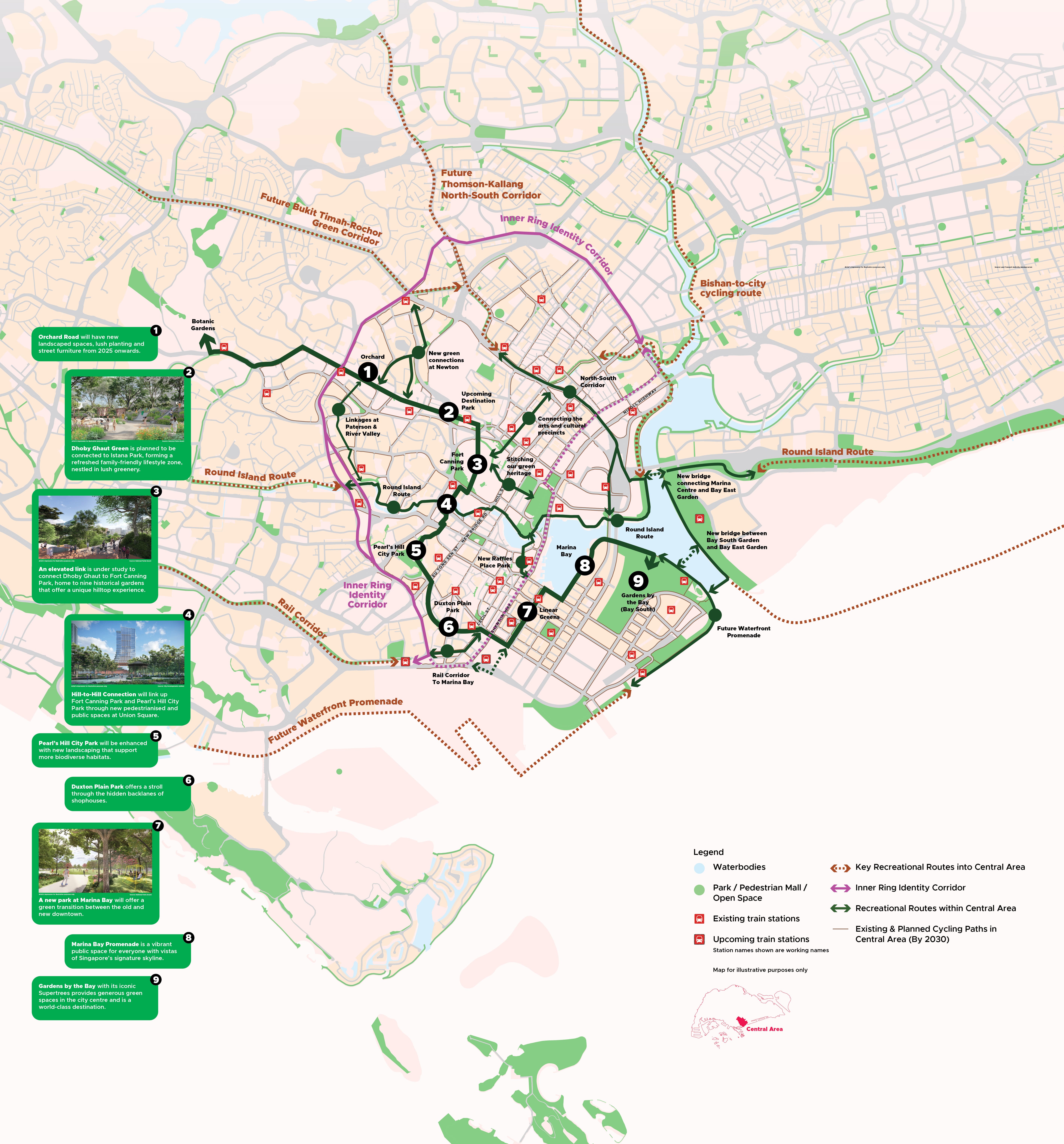
Today, the Central Area is well-endowed with major green and blue spaces such as Gardens by the Bay, Fort Canning Park, as well as the Singapore River and Marina Bay, providing multiple avenues for recreation. Future enhancements in walking and cycling networks will provide seamless connections and new corridors, making recreation and travel more accessible for all.
From Botanics to the Bay
Enjoy a 10km walk through various parks, open spaces and waterfronts with new pedestrian-friendly routes that will better link up the green nodes between the Singapore Botanic Gardens and Gardens by the Bay!
Streets for the community along the North-South Corridor

Artist’s impression for illustrative purposes only - Source: Land Transport Authority, Henning Larson
Imagine part of Ophir Road evolving from a busy thoroughfare into a vibrant public space at the intersection of Rochor Canal and Ophir Road.
As traffic moves underground through the North-South Corridor's tunnels, some road spaces at street level are freed up to be reimagined as new public spaces. Key streets at the Bras Basah.Bugis, Little India and Kampong Glam precincts could be potentially enhanced with wider walkways, cycling paths and spaces for the community.
A more active Inner Ring

Originally serving as trunk roads around the city centre, this identity corridor connects many charming neighbourhoods that have developed along it, such as Jalan Besar, Tiong Bahru and Newton.
New cycling paths from Outram to Orchard and from Lavender to Balestier will enhance connections along the Inner Ring and to other key routes like the Rail Corridor, Round Island Route, and Kallang River. Each 'charm' along this corridor tells its own story and together, they weave a rich narrative of Singapore’s development through the years.
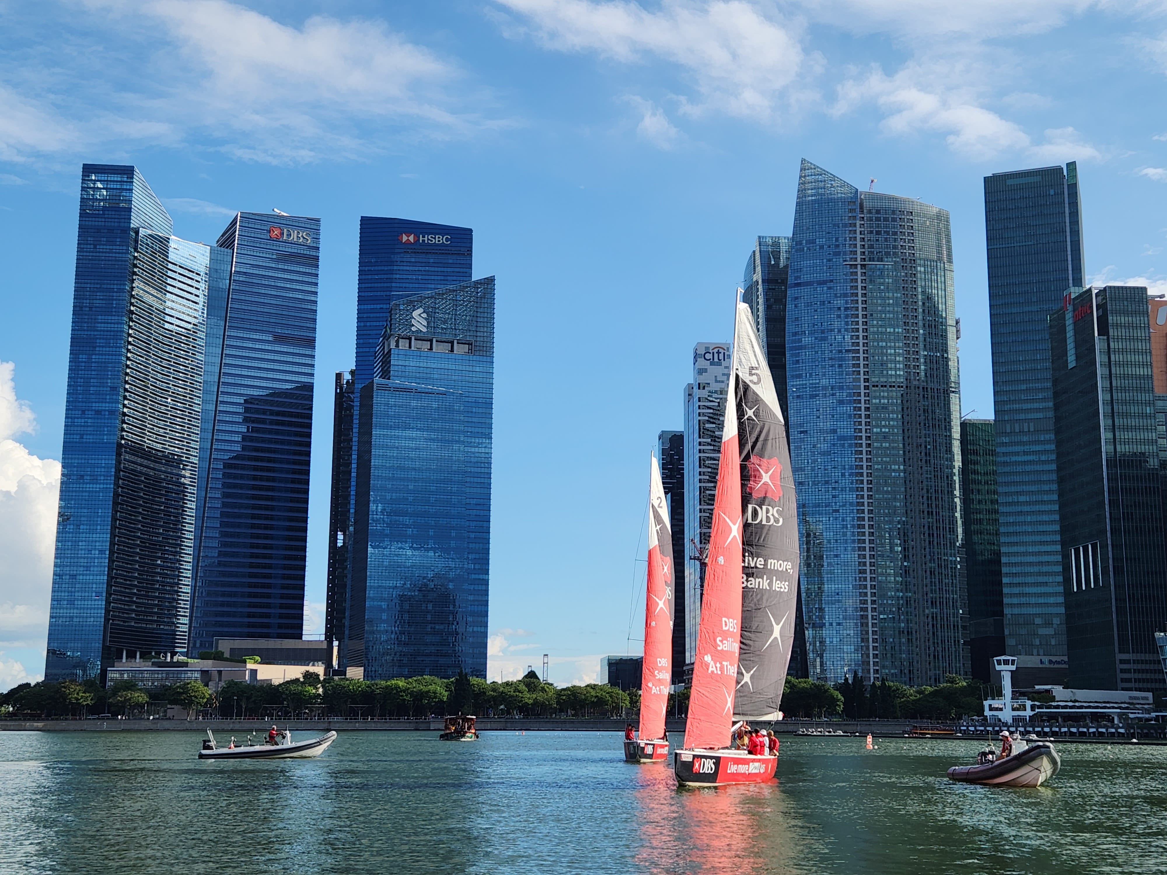
Three Waterbodies, Multiple Experiences
Our three waterbodies of the Central Area - Marina Bay, Marina Channel and Kallang Basin will welcome new recreational, sporting, and lifestyle attractions as well as waterfront residential precincts in the coming years. They will also be connected through a continuous, accessible 12km-long waterfront promenade to offer more scenic views of the city.

More places for play
New activities and infrastructure, including the upcoming PAssion Wave Outpost @ Bayfront and NS Square, will enhance recreation on the waterbodies through the introduction of water-based activities such as dragon boating, kayaking and pedal boating within Marina Bay. This will add another element of fun in the Central Area.
NS Square
The upcoming NS Square will feature a distinctive stage deck and public space for events, new water sports facilities, dining options, a waterfront promenade and an NS-themed gallery.
Artist’s impression for illustrative purposes only - Source: MINDEF and MND
Passion Wave Outpost
A launch point for upcoming Passion Wave Outpost @ Bayfront will create more water recreational opportunities in Marina Bay.

Source: People's Association

Continuous and seamless experience along and across the water
Today, the continuous waterfront promenade around the three waterbodies provides an enjoyable experience for walking, cycling and jogging. Two new bridges currently under study will further enhance this:

Artist’s impression for illustrative purposes only - Source: Aedas
A new bridge between Bay South Garden and Bay East Garden will link the two Gardens, enhancing accessibility and adding a delightful experience while improving access within the larger Marina Bay area for users of the waterfront promenade.

A new bridge connecting Marina Centre and Bay East Garden will enable a more direct walking and cycling connection along the Round Island Route, reducing travelling time between the city and the East Coast by 2029.